
20260825172024.jpg)
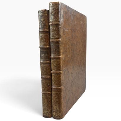
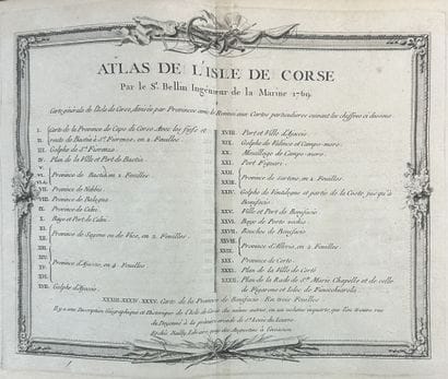
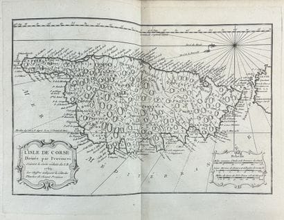
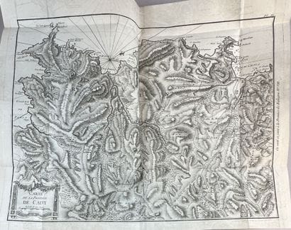

Sale information - Corsican Collections: Paintings, Sculptures, Furniture, Art Objects, Jewelry, and Fashion
SATURDAY, NOVEMBER 21, 2026, at 11 a.m. (resuming at 2 p.m.)
PART 1 at 11:00 a.m.: Lots 1 through 86
PART 2 at 2:00 p.m.: lots 87 through 473
Requests for condition reports via email: etude@asta-encheres.com
Phone: 04 95 55 64 75
HOTEL OSTELLA, 17 RUE DU MARECHAL JUIN, 20600, BASTIA
Public viewings at the Ostella Hotel:
Thursday, November 19, 2025, from 2:30 p.m. to 7:00 p.m.
Friday, November 20, 2025, from 11:00 a.m. to 7:00 p.m.
Saturday, November 21, 2025, from 11:00 a.m. to 12:00 p.m. (Part 2 only)
ANTIQUE AND MODERN PAINTINGS
JEWELRY, WATCHES, COINS
VINTAGE FASHION
SILVERWARE, GLASSWARE, SCULPTURES
WORKS OF ART
AUCTION CURATOR
Vincent BRONZINI de CARAFFA
etude@asta-encheres.com
EXPERTS:
* JEWELRY
VENDOME EXPERTISE
Xavier LAFOSSE
25 rue Drouot, 75009 Paris
xavierlafosse@vendome-expertise.com
Lots: 242, 261, 267, and 345.
* NUMISMATICS
Florian CHAUVIN
Lots 36 through 38, 50 through 72.
Request condition reports by email: florian.chauvin58@gmail.com
Lots may be viewed at 22 rue Feydeau, 75002 PARIS by appointment through November 15, 2026
* STAMP COLLECTING
Louis Edouard BEHR
Lot 34
info@behrauction.fr
Lot sold by description and available for viewing at the appraiser’s office in Paris.
* HISTORICAL MEMORABILIA & RUSSIAN ART
Maxime CHARRON
expert@maxime-charron.com
Lots 133 and 307.
* 20TH-CENTURY DECORATIVE ARTS
Guillaume ROULIN (Cabinet Fiftease)
06 84 84 19 00 - info@fiftease.com
Lot: 408.
* ANTIQUE PAINTINGS AND DRAWINGS
Pierre-Antoine MARTENET
06 08 17 28 49
pam@martenetrombout.com
Lots: 73, 88–92.
Sales conditions - Corsican Collections: Paintings, Sculptures, Furniture, Art Objects, Jewelry, and Fashion
NOUS ATTIRONS VOTRE ATTENTION SUR LES POINTS SUIVANTS :
-L'ENLEVEMENT DES LOTS EST A LA CHARGE DES ACHETEURS. THE PACKENGERS NE VIENT PAS EN CORSE.
-LA SOCIETE MAILBOXES CANNES SERA PRESENTE A BASTIA DEBUT le 4 DECEMBRE 2026 POUR PROCEDER A L'ENLEVEMENT ET AU TRANSPORT DE VOS LOTS. VOUS POUVEZ LEUR DEMANDER UN DEVIS AVANT (conseillé) OU APRES LA VENTE. MERCI DE LES CONTACTER PAR MAIL A L'ADRESSE SUIVANTE : mbe3218@mbefrance.fr OU PAR TELEPHONE AU 04 22 32 91 67. LES LOTS NE SERONT DELIVRES A MAILBOXES QU'APRES PAIEMENT INTEGRAL DU BORDEREAU D'ADJUDICATION. IL CONVIENDRA DE REGLER LA SOCIETE MBE CANNES ET DE LEUR DONNER MANDAT POUR QUE CEUX-CI ENLEVENT VOS LOTS.
-LES ENVOIS D'ACHATS DE PETITS OBJETS PEUVENT ÊTRE EFFECTUES AU SEIN DE L’UNION EUROPÉENNE DANS LA MESURE DU POSSIBLE, AVEC ASSURANCE, AUX FRAIS DE L'ADJUDICATAIRE, SUR DEMANDE AUPRES DE LA MAISON de VENTES ASTA (merci de poser les questions relatives aux envois avant la vente). CEUX-CI NESSECITERONT PREALABLEMENT LA SIGNATURE D'UNE DECHARGE DE RESPONSABILITE DE LA MAISON DE VENTES ASTA. VOTRE BORDEREAU SERA ALORS MODIFIE, INCLUANT LES FRAIS D'ENVOI PAR COLISSIMO.
-APRES LA VENTE, L'ENSEMBLE DES LOTS REVIENDRONT DANS LES LOCAUX D'ASTA (Résidence Ornano, rue chanoine Bonerandi, 20200 BASTIA).
-LES ACHATS SONT A RECUPERER SUR RENDEZ-VOUS (merci d'appeler l'étude préalablement pour que nous vous préparions vos lots, spécialement pour les bijoux) DANS NOS LOCAUX A PARTIR DU 23 OCTOBRE 2026.
-VOUS POUVEZ CONTACTER LE TRANSPORTEUR DE VOTRE CHOIX POUR L'ENLEVEMENT DE VOS ACHATS, CE DERNIER DEVRA PRENDRE RENDEZ-VOUS AVEC L'ETUDE EN AMONT DE LA RECUPERATION DES LOTS, L'ETUDE N'ETANT OUVERTE QUE SUR RENDEZ-VOUS. LES ENVELOPPES PREPAYEES NE SONT PAS ACCEPTEES, NI LES TRANSPORTEURS OU SERVICE DE "PICK-UP" (TYPE DHL ou FEDEX) N'ETANT PAS EN MESURE DE NOUS DONNER UN HORAIRE PRECIS DE LEUR PASSAGE.
-LES ACHATS SONT CONSERVES GRATUITEMENT DANS NOTRE ETUDE (Résidence Ornano, rue chanoine Bonerandi, 20200 BASTIA) PENDANT UN MOIS APRES LA VENTE. PASSE CE DELAI, DES FRAIS DE 2€ HT PAR JOUR PAR LOT S'APPLIQUERONT. POUR LES OBJETS DONT LA HAUTEUR, LA LARGEUR OU LA LONGUEUR EST SUPERIEURE A 60 CM, LES FRAIS DE STOCKAGE SERONT DE 10€ HT PAR JOUR PAR OBJET.
La vente se fera expressément au comptant.
Aucune réclamation ne sera recevable dès l’adjudication prononcée, les expositions successives ayant permis aux acquéreurs de constater l’état des objets présentés.
L’adjudicataire sera le plus offrant et dernier enchérisseur, et aura pour obligation de remettre ses nom et adresse.
Il devra acquitter, en sus du montant de l'enchère, par lot, les frais et taxes suivants :
- 26% TTC (soit 24,64% H.T. (TVA 5,5%) pour les livres et manuscrits, et 21,66% H.T. (TVA 20%) pour tout autre lot) ;
Paiement :
La vente est faite au comptant et conduite en euros.
Le paiement doit être effectué immédiatement après la vente, ou même pendant la vente, en salle, par carte bleue (ce qui vous permet de récupérer aussitôt vos achats).
MERCI DE PRIVILÉGIER LES REGLEMENTS PAR CARTE BLEUE sur notre site internet : https://https://asta-encheres.com/paiement-en-ligne
CONDITIONS GÉNÉRALES D’ACHAT
La société à responsabilité limitée ASTA est un opérateur de ventes volontaires de meubles aux
enchères publiques régi par les articles L. 321-4 et suivants du Code de commerce. En cette
qualité ASTA agit comme mandataire du vendeur qui contracte avec l’adjudicataire par son
intermédiaire. Les rapports entre ASTA et l’enchérisseur sont soumis aux présentes conditions
générales d’achat (ci-après, les « CGA »).
ACCEPTATION, OPPOSABILITÉ ET MODIFICATION DES CGA
Les CGA sont applicables sans restriction ni réserve à la relation entre ASTA et tout enchérisseur.
Les CGA sont communiquées préalablement à la vente sur le site Internet de ASTA, ainsi que dans
le catalogue de la vente concernée.
L’enchérisseur déclare avoir pris connaissance des CGA et les accepte en portant une enchère,
quel qu’en soit le moyen. Les CGA applicables à la relation entre les parties sont celles en vigueur
au moment de la vente concernée en tenant compte des éventuelles modifications écrites ou
orales émises avant la vente et qui sont reportées au sein du procès-verbal de vente.
AVANT LA VENTE
1. Indications relatives aux lots
Les notices d’information contenues dans le catalogue sont établies, en l’état des connaissances
au jour de la vente, avec toutes les diligences requises, par ASTA et l’expert qui l’assiste le cas
échéant, sous réserve des notifications, déclarations, rectifications, annoncées verbalement au
moment de la présentation du lot et portées au procès-verbal de la vente.
1.1 État des lots
Les lots sont vendus dans l’état dans lequel ils se trouvent au moment de la vente et il relève ainsi
de la responsabilité des futurs enchérisseurs d’examiner chaque lot avant la vente et notamment
lors des expositions. L’absence de mention dans le catalogue n’implique aucunement que le lot
soit en parfait état de conservation ou exempt de dommages, accidents, incidents ou
restaurations. Seule l’existence de réparations, ainsi que de restaurations, manques et ajouts
significatifs dont le lot peut avoir fait l’objet a vocation à être indiquée. Les dimensions et poids
des lots sont donnés à titre indicatif. De même, la mention de défectuosités n’implique pas
l’absence d’autres défauts. Des constats d’état ou de conservation des objets peuvent être établis
sur demande et par commodité pour tout lot supérieur à une valeur de deux-cents (200) euros.
1.2 Œuvres d’art et objets de collection
ASTA rappelle que l’emploi du terme « attribué à » suivi d’un nom d’artiste garantit que l’œuvre ou
l’objet a été exécuté pendant la période de production de l’artiste mentionné et que des
présomptions sérieuses désignent celui-ci comme l’auteur vraisemblable. « Entourage de » signifie
que le tableau est l’œuvre d’un artiste contemporain de l’artiste mentionné qui s’est montré très
influencé par l’œuvre du maître. L’emploi des termes « atelier de » suivis d’un nom d’artiste
garantit que l’œuvre a été exécutée dans l’atelier du maître cité mais réalisé par des élèves sous sa
direction. Les expressions « dans le goût de », « style », « manière de », « genre de », « d’après »,
« façon de » ne confèrent aucune garantie particulière d’identité d’artiste, de date de l’œuvre ou
d’école. Les biens d’occasion ne bénéficient pas de la garantie légale de conformité visée à
l’article L. 217-2 du Code de la consommation.
1.3 Provenance
ASTA rappelle que les mentions concernant la provenance d’un lot sont fournies sur indication du
vendeur et ne sauraient entraîner la responsabilité d’ASTA. Si le vendeur a requis la confidentialité
ou si l’identité des précédents propriétaires est inconnue du fait de l’ancienneté du lot, aucune
indication relative à la provenance n’est portée au sein de la notice d’information.
1.4 Modifications des informations
Les informations figurant au catalogue peuvent faire l’objet de modifications ou de rectifications
jusqu’au moment de la vente. Ces changements sont portés à la connaissance du public par une
annonce faite par le commissaire-priseur habilité au moment de la vente et par un affichage
approprié en salle. Ces modifications sont consignées au procès-verbal de la vente.
1.5 Lot suivi d’un *
Les lots suivis d’un « * » sont vendus par ASTA ou par un membre d’ASTA, par un expert sollicité
par ASTA ou par tout partenaire d’ASTA.
1.6 Illustration des lots
Les photographies des lots mis en vente figurant au catalogue et sur le site Internet d’ASTA ainsi
que sur les plateformes des opérateurs intermédiaires d’ASTA n’ont pas de valeur contractuelle
supérieure à la description opérée dans le catalogue. Les photographies sont données à titre
indicatif impliquant que les couleurs des œuvres reproduites dans le catalogue sont susceptibles
de différer des couleurs réelles.
1.7 Pierres et bijoux
Les pierres et bijoux présentés à la vente peuvent avoir fait l’objet de traitements destinés
uniquement à les mettre en valeur (notamment, et de manière non limitative : huilage des
émeraudes, traitement thermique des rubis et saphirs, blanchissement des perles, etc.) et
n’altérant en rien leur qualité. Les pierres présentées sans certificat de laboratoire sont vendues
sans garantie aucune d’un éventuel traitement.
1.8 Montres
Les articles d’horlogerie et les montres peuvent comporter des pièces qui ne sont pas d’origine.
Les restaurations, caractéristiques techniques, numéros de série, dimensions et poids sont donnés
à titre indicatif. Il est renvoyé à l’Article 1.1 quant à l’état de ces lots. Les frais relatifs aux
révisions, aux réglages et à l’étanchéité sont à la charge exclusive de l’adjudicataire.
2. Estimations des lots
ASTA rappelle que les estimations sont fondées sur l’état, la rareté, la qualité et la provenance des
lots et sur les prix récemment atteints aux enchères pour des biens similaires. Les estimations
peuvent changer. Les estimations sont ainsi fournies à titre purement indicatif et elles ne peuvent
être considérées comme impliquant la certitude que le lot soit vendu au prix estimé ou même à
l’intérieur de la fourchette d’estimations. Les estimations ne sauraient ainsi constituer une
quelconque garantie. Les estimations ne comprennent ni les frais de vente ni aucune taxe ou frais
applicables.
3. Retrait de tout lot
ASTA peut librement retirer un lot à tout moment avant la vente ou pendant la vente aux enchères.
Cette décision de retrait n’engage en aucun cas la responsabilité d’ASTA à l’égard de tout
enchérisseur.
4. Exposition publique préalable à la vente
ASTA est libre d’organiser des expositions publiques préalablement à la vente et dont les modalités
sont précisées sur le catalogue ou sur tout support de la vente concernée. Tout enchérisseur est
invité à examiner les lots préalablement à la vente.
LA VENTE
En vue d’une bonne organisation des ventes, les enchérisseurs sont invités à se faire connaître
auprès d’ASTA, avant la vente, afin de permettre l’enregistrement de leurs données personnelles.
ASTA se réserve le droit de demander à tout enchérisseur de justifier de son identité, ainsi que de
ses références bancaires et d’effectuer un dépôt de garantie, dont le montant est restitué dans les
soixante-douze (72) heures après la vente si le lot n’a pas été adjugé à l’enchérisseur. ASTA se
réserve le droit d’interdire l’accès à la vente de tout enchérisseur pour justes motifs.
L’enchérisseur est réputé s’inscrire et enchérir pour son propre compte. S’il enchérit pour autrui,
l’enchérisseur doit indiquer à ASTA qu’il est dûment mandaté par un tiers pour lequel il
communiquera une pièce d’identité et les références bancaires. Toute fausse indication engagera
la responsabilité de l’enchérisseur. Si l’enchérisseur agit en tant qu’agent pour un mandant
occulte il accepte expressément d’être tenu personnellement responsable de payer le prix d’achat
et toutes autres sommes dues.
Les enchères peuvent être portées selon plusieurs modes.
1. Enchères en salle
ASTA rappelle que le mode usuel pour enchérir consiste à être présent en salle pendant la vente, à
moins que la vente ne soit réalisée de manière totalement dématérialisée (vente online). ASTA ne
peut engager sa responsabilité pour tout autre mode de passation des enchères notamment si une
erreur qu’elle soit d’ordre technique ou non, une omission ou une difficulté de liaison ou de
connexion existait.
2. Ordres d’achat ferme
ASTA se propose d’exécuter les ordres d’achat selon les instructions de l’enchérisseur absent et
s’engage à faire son possible pour acquérir dans les meilleures conditions le lot convoité.
L’enchérisseur adresse sa demande à ASTA accompagnée (i) d’un document d’identification (carte
d’identité recto-verso pour les personnes physiques, extrait Kbis pour les personnes morales) et
(ii) de coordonnées postales, électroniques et téléphoniques. Toute demande d’ordre d’achat
ferme doit avoir reçu une confirmation de ASTA pour être exécutée. Dans le cas de plusieurs
ordres d’achat identiques, la priorité est donnée à celui reçu en premier. Dans certains cas, la
prise en compte d’un ordre d’achat peut être conditionnée à un dépôt de garantie.
3. Enchères téléphoniques
ASTA accepte gracieusement de recevoir les enchères téléphoniques à condition que l’adjudicataire
potentiel se soit manifesté avant la vente. L’enchérisseur adresse sa demande à ASTA
accompagnée (i) d’un document d’identification (carte d’identité recto-verso pour les personnes
physiques, extrait Kbis pour les personnes morales) et (ii) de coordonnées postales, électroniques
et téléphonique. Toute demande d’enchère téléphonique doit avoir reçu une confirmation de
ASTA pour être exécutée. ASTA décline toute responsabilité en cas d’erreurs éventuelles, d’insuccès
si la liaison téléphonique ne peut être établie ou de non réponse suite à une tentative d’appel.
ASTA peut enregistrer les communications et peut les conserver jusqu’au règlement des éventuelles
acquisitions. Dans certains cas, la prise en compte d’enchères téléphoniques peut être
conditionnée à un dépôt de garantie.
4. Enchères en ligne par des plateformes tierces
ASTA peut proposer d’enchérir en ligne par le biais de tout site Internet de plateformes
d’opérateurs intermédiaires relayant la vente. Ces sites Internet constituent des plateformes
techniques permettant de participer à distance par voie électronique aux ventes aux enchères
publiques ayant lieu dans des salles de ventes. L’utilisateur souhaitant participer à une vente aux
enchères en ligne via ces sites Internet doit prendre connaissance et accepter, sans réserve, les
conditions d’utilisation de ces plateformes, qui sont indépendantes et s’ajoutent aux présentes
conditions générales d’achat, et notamment vérifier l’application de tout frais éventuel pour
l’utilisation de ces sites Internet tiers.
DROUOT LIVE
Tout intéressé pourra s’inscrire sur https://https://drouot.com/ afin de suivre notre vente en Live et enchérir pendant la vente.
L’adjudicataire via cette plateforme devra s’acquitter, en sus des frais de la Maison de ventes ASTA, des frais d’utilisation de la plateforme de 1,5% H.T., soit 1,8% TTC (ainsi 26% TTC + 1,8% TTC).
INTERENCHERES
L’adjudicataire via cette plateforme devra s’acquitter, en sus des frais de la Maison de ventes ASTA, des frais d’utilisation de la plateforme de 3% H.T., soit 3,6% TTC (ainsi 26% TTC + 3,6% TTC).
5. Ventes online
ASTA organise des ventes online par le biais de plateformes d’opérateurs intermédiaires.
L’utilisateur souhaitant participer à une vente aux enchères en ligne via ces sites Internet doit
prendre connaissance et accepter, sans réserve, les conditions d’utilisation de ces plateformes, qui
sont indépendantes et s’ajoutent aux présentes conditions générales d’achat, et notamment
vérifier l’application de tout frais éventuel pour l’utilisation de ces sites Internet tiers.
DÉROULEMENT DE LA VENTE
Le commissaire-priseur habilité organise et dirige les enchères de façon discrétionnaire, la
conduite de la vente suit l’ordre de la numérotation du catalogue et les paliers d’enchères sont à
sa libre appréciation. Le commissaire-priseur habilité veille au respect de la liberté des enchères et
à l’égalité entre les enchérisseurs. Il dispose de la faculté discrétionnaire de refuser toute enchère,
de retirer un lot de la vente et de désigner l’adjudicataire, c’est-à-dire le plus offrant et le dernier
enchérisseur, une fois le terme « adjugé » prononcé. Les enchères en salle priment sur toute autre
enchère.
Lors de la vente, ASTA est en droit de déplacer des lots, de réunir ou de séparer des lots ou de
retirer des lots de la vente. En cas de contestation au moment de l’adjudication, c’est-à-dire s’il
est établi que deux ou plusieurs enchérisseurs ont simultanément porté une enchère équivalente,
soit à haute voix, soit par signe, et réclament en même temps cet objet après le prononcé du mot
« adjugé », ledit objet est immédiatement remis en vente au prix proposé par les enchérisseurs et
tout le public présent est admis à enchérir à nouveau.
La vente se fait expressément au comptant et est conduite en euros. ASTA peut toutefois offrir, à
titre indicatif, la retranscription des enchères en devises étrangères. En cas d’erreur de conversion
de devises, la responsabilité d’ASTA ne peut être engagée.
Les paliers d’enchères sont laissés à la libre discrétion du commissaire-priseur chargé de la vente
aux enchères publiques.
Prix de réserve
Le prix de réserve s’entend du prix minimum confidentiel au-dessous duquel le lot ne sera pas
vendu. Le prix de réserve ne peut dépasser l’estimation basse figurant au catalogue ou modifiée
publiquement avant la vente et le commissaire-priseur habilité est libre de débuter les enchères
en dessous de ce prix et de porter des enchères pour le compte du vendeur. En revanche, le
vendeur ne peut porter aucune enchère pour son propre compte ou par le biais d’un mandataire.
Préemption
Les articles L. 123-1 et L. 123-2 du Code du patrimoine autorisent, dans certains cas, l’État à
exercer un droit de préemption, c’est-à-dire la faculté pour l’État de se substituer à l’adjudicataire,
sur les œuvres d’art mises en vente publique ou à l’occasion de ventes de gré à gré après une
vente aux enchères publiques préalable infructueuse. Le représentant de l’État présent lors de la
vacation formule sa déclaration auprès du commissaire-priseur habilité juste après la chute du
marteau. La décision de préemption doit ensuite être confirmée dans un délai de quinze (15)
jours. Par ailleurs, et conformément à l’article R. 123-7 du Code de commerce, le droit de
préemption peut être exercé par voie électronique. En pareille situation, la décision de
préemption doit être confirmée dans un délai de quatre (4) heures à compter de la réception du
résultat par le représentant de l’État. En aucun cas, ASTA ne peut assumer une quelconque
responsabilité du fait des décisions administratives de préemption.
Ventes de gré à gré ou after sale
ASTA peut organiser des ventes de gré à gré au sein desquelles le vendeur et un potentiel
enchérisseur, par l’intermédiaire d’ASTA, s’entendent sur le prix de vente d’un ou de plusieurs lots.
Par ailleurs, en cas de lots restés invendus, ASTA peut procéder, avec l’accord du vendeur, à la
vente du ou des lots en after sale selon les modalités qu’elle détermine.
EXÉCUTION DE LA VENTE
L’adjudication réalise le transfert de propriété. L’adjudicataire doit enlever le ou les lots dans les
plus brefs délais après avoir procédé à leur règlement intégral.
La vente est faite au comptant et est conduite en euros. Aucun lot n’est remis aux adjudicataires
avant l’acquittement de l’intégralité des sommes dues. En cas de paiement par virement, la
délivrance des objets peut être différée jusqu’à l’encaissement. Les frais de dépôt sont, en ce cas,
à la charge de l’adjudicataire.
Dans l’hypothèse où l’adjudicataire ne se serait pas fait enregistrer avant la vente, il doit
communiquer les renseignements nécessaires dès l’adjudication du lot prononcée.
1. Frais de vente – Droit de suite
En sus du prix d’adjudication, c’est-à-dire du « prix marteau », l’adjudicataire doit acquitter en
principe de frais de 21,67 % HT (soit 26 % TTC), exception faite des ventes de livres pour
lesquelles les frais sont de 24,64 % HT (soit 26 % TTC). Ces frais peuvent être modulés pour
certaines ventes particulières. Des frais additionnels peuvent être facturés lorsque l’enchère est
portée par le biais de plateformes de ventes en ligne tierces, l’enchérisseur est alors invité à se
reporter aux conditions particulières propres à ces plateformes.
Le paiement du lot par l’adjudicataire se fait immédiatement pour l’intégralité du prix d’achat,
c’est-à-dire le prix d’adjudication, plus les frais et les taxes éventuelles. Cette condition s’applique
également à l’adjudicataire souhaitant exporter le lot et même en cas de nécessité d’obtention
d’une licence d’exportation.
ASTA étant sous le régime fiscal de la marge prévu à l’article 297A du Code général des impôts, elle
ne peut délivrer aucun document faisant ressortir la TVA. Les lots en provenance d’une zone en
dehors de l’Union européenne, et dont la présentation est précédée par le symbole « ° » sont
soumis à des frais additionnels pouvant être rétrocédés à l’adjudicataire sur présentation des
documents douaniers d’exportation hors Union Européenne dans un délai de trois mois. Ces
frais sont de 5.5% sur le prix de l’adjudication. Les lots dont la présentation est précédée par le
symbole « °° » sont soumis à des frais additionnels de 20% sur le prix de l’adjudication.
L’adjudicataire justifiant d’un numéro de TVA intracommunautaire et d’un document prouvant
la livraison dans son État membre de l’Union européenne peut obtenir le remboursement de la
TVA sur les commissions.
La répartition entre prix d’adjudication et commissions peut être modifiée par convention
particulière entre le vendeur et ASTA, sans conséquence pour l’adjudicataire.
Pour autant que l’œuvre remplisse les conditions d’éligibilité de l’article R. 122-3 du Code de la
propriété intellectuelle et que le prix de vente hors taxe du lot atteigne 750 euros, l’adjudicataire
est redevable du droit de suite selon les modalités légales. S’il apparaît qu’un droit de suite n’a pas
été comptabilisé alors qu’il est pourtant dû, l’adjudicataire règle le montant à première demande
par l’intermédiaire d’ASTA et la décharge de toute responsabilité et réclamation à cet égard.
2. Paiement
L’adjudicataire peut effectuer son règlement par les moyens suivants :
● en espèces : jusqu’à 1.000 euros frais et taxes compris pour les particuliers français et
pour les commerçants, jusqu’à 15.000 euros frais et taxes compris pour les ressortissants
étrangers non commerçants sur présentation de leur pièce d’identité avec une adresse à
l’étranger ;
● par carte bancaire Visa ou Mastercard (à l’exclusion des American Express) ;
● par virement bancaire sur le compte bancaire d’ASTA dont les coordonnées sont les
suivantes : IBAN : FR76 3000 3002 5000 0220 4222 453 – BIC : SOGEFRPP, étant
rappelé que les éventuels frais additionnels de transfert ou de change sont à la seule
charge de l’adjudicataire.
Les règlements par chèque ne sont pas acceptés.
Le paiement doit être réalisé au seul nom de l’adjudicataire. ASTA rappelle qu’aucun paiement ne
peut être réalisé pour un tiers et qu’aucune modification de l’identité de l’adjudicataire ne peut
intervenir postérieurement à la vente aux enchères publiques.
Le transfert de propriété ainsi que le transfert des risques s’opérant au prononcé du terme «
adjugé » par le commissaire-priseur habilité, ASTA rappelle à l’adjudicataire qu’il est lui-même
chargé de faire assurer ses acquisitions et décline toute responsabilité quant aux dommages que
l’objet pourrait subir ou faire subir dans le cas où l’adjudicataire n’aurait pris aucune disposition.
3. Défaut de paiement
Conformément à l’article L. 321-14 du Code de commerce, à défaut de paiement par
l’adjudicataire, et après mise en demeure restée infructueuse adressée à l’adjudicataire par lettre
recommandée avec accusé de réception, le bien est remis en vente à la demande du vendeur sur
réitération des enchères. Si le vendeur ne formule pas cette demande dans un délai de trois (3)
mois à compter de l’adjudication, ASTA a mandat d’agir en son nom et pour son compte et peut,
selon son choix :
notifier à l’adjudicataire défaillant la résolution de plein droit de la vente, sans préjudice
des éventuels dommages-intérêts. L’adjudicataire défaillant demeure redevable des frais
de vente ;
poursuivre l’exécution forcée de la vente et le paiement du prix d’adjudication et des frais
de vente, pour son propre compte et/ou pour le compte du vendeur, montant auquel
s’ajoutent quarante euros de frais de recouvrement par lot.
ASTA se réserve le droit d’exclure des ventes futures tout adjudicataire ou représentant de tout
adjudicataire qui a été défaillant ou qui n’a pas respecté les présentes conditions générales
d’achat. Par ailleurs, ASTA se réserve la possibilité d’inscrire l’adjudicataire ou son représentant à la
liste noire des mauvais payeurs de Drouot SI, lui interdisant ainsi d’utiliser les services de la
plateforme Drouot.com.
ASTA se réserve également le droit de procéder à toute compensation avec les sommes
éventuellement dues à l’adjudicataire défaillant.
4. Délivrance des lots
Les lots sont conservés au sein des locaux d’ASTA, situés sis Résidence Ornano, rue chanoine
Bonerandi – 20200 BASTIA. Tout lot ne peut être délivré à l’adjudicataire qu’après paiement
intégral du prix, des frais et des taxes. Tout lot doit être récupéré sur rendez-vous selon les
modalités précisées par ASTA. Hors conditions particulières applicables aux ventes se tenant dans
tout autre lieu de vente non directement géré par ASTA, et à compter du trentième (30e) jour après
la vente, le lot acheté réglé ou non réglé restant à l’étude ou dans l’entrepôt de stockage de
l’étude, fait l’objet d’une facturation de deux (2) euros HT par jour et par lot au titre des frais
d’entreposage et d’assurance. Pour tout lot adjugé, réglé ou non, demeurant stocké dans un autre
lieu que tout lieu géré directement par ASTA, l’adjudicataire fait son affaire des frais liés au
stockage et aux éventuelles pénalités de retard s’inférant des conditions particulières qui lui est
applicable et ne peut en tenir rigueur à ASTA.
Le transfert des risques sur les lots s’opère au moment de l’adjudication lorsque l’adjudicataire
revêt la qualité de professionnel, au sens de l’article liminaire du Code de la consommation, de
telle sorte que la responsabilité d’ASTA ne peut être reconnue en cas de perte ou de dommages
causés sur le ou les lots. Le transfert des risques à l’adjudicataire consommateur ou non-
professionnel s’opère lorsque celui-ci ou un tiers désigné par lui prend physiquement possession
des lots. Il est entendu que les risques sont transférés au transporteur désigné par l’adjudicataire
consommateur ou non-professionnel lorsque celui-ci prend possession des lots. Le transport des
lots doit être effectué aux frais et sous l’entière responsabilité de l’adjudicataire.
L’adjudicataire est lui-même chargé de faire assurer ses acquisitions, et ASTA décline toute
responsabilité quant aux dommages que le lot pourrait encourir et ceci dès l’adjudication
prononcée.
Toutes les formalités et transports restent à la charge exclusive de l’adjudicataire, quelle que soit
sa qualité. ASTA peut recommander sur simple demande des entreprises de transport qui prennent
alors en charge l’emballage et le transport des achats réalisés. Les sociétés de transport n’étant
pas les préposées de ASTA, elle ne peut être responsable de leurs actes ou omissions.
L’adjudicataire ayant opté pour un envoi de ses achats par une société de transport adhère aux
conditions générales de ce prestataire et écarte la possibilité d’engager la responsabilité de ASTA en
cas de préjudice subi dans le cadre de cette prestation de services.
L’adjudicataire, quelle que soit sa qualité, peut adresser par écrit une demande à ASTA afin que
celle-ci procède à la remise des lots à un transporteur, notamment et de manière non limitative
par l’intermédiaire de Colissimo, aux frais exclusifs de l’adjudicataire. En pareille hypothèse, et
lorsque l’adjudicataire revêt la qualité de consommateur ou de non-professionnel, il est entendu
entre les parties que la demande de transport des lots a été formulée par l’adjudicataire, lequel
assume les risques de perte ou d’endommagement des lots à compter de la remise des lots au
transporteur.
5. Éventuel droit de rétractation du client consommateur pour l’achat d’un lot
appartenant à un vendeur professionnel dans le cadre de ventes entièrement
dématérialisées
L’adjudicataire consommateur, entendu comme toute personne physique qui agit à des fins qui
n’entrent pas dans le cadre de son activité commerciale, industrielle, artisanale, libérale ou
agricole est informé qu’il dispose d’un droit de rétraction lorsque (i) le vendeur est un
professionnel – entendu comme toute personne physique ou morale, publique ou privée, qui agit
à des fins entrant dans le cadre de son activité commerciale, industrielle, artisanale, libérale ou
agricole – et (ii) que la vente est entièrement dématérialisée, en ce qu’elle se tient sans que
quiconque n’ait la capacité d’assister à la vente en personne. Lorsque ce droit s’applique,
l’adjudicataire consommateur dispose d’un délai de quatorze (14) jours suivant le lendemain de
livraison ou de la délivrance du lot pour exercer ce droit. Les lots pouvant bénéficier d’un droit
de rétractation éventuel sont indiqués par le symbole « # ».
CITES ET EXPORTATION DES BIENS CULTURELS
L’exportation hors de France ou l’importation dans un autre pays d’un lot peut être affectée par
les lois du pays vers lequel il est exporté ou importé. L’exportation de tout lot hors de France ou
l’importation dans un autre pays peut être soumise à l’obtention d’une ou plusieurs
autorisation(s) d’exporter ou d’importer. Certaines lois peuvent interdire l’importation ou
interdire la revente d’un lot dans le pays dans lequel il a été importé. L’exportation de certains
lots dans un pays de l’Union Européenne est subordonnée à l’obtention d’un certificat
d’exportation délivré par les services compétents du Ministère de la Culture, dans un délai
maximum de quatre (4) mois à compter de sa demande.
La réglementation internationale du 3 mars 1973, dite Convention de Washington a pour objet la
protection de spécimens et d’espèces dits menacés d’extinction. L’exportation ou l’importation
de tout lot fait ou comportant une partie (quel qu’en soit le pourcentage) en ivoire, écailles de
tortues, peau de crocodile, corne de rhinocéros, os de baleine, certaines espèces de corail et en
palissandre, etc. peut être restreinte ou interdite. Il appartient, sous sa seule responsabilité, à
l’adjudicataire de prendre conseil et de vérifier la possibilité de se conformer aux dispositions
légales ou règlementaires qui peuvent s’appliquer à l’exportation ou l’importation d’un lot, avant
même d’enchérir.
Dans certains cas, le lot concerné ne peut être transporté qu’assorti d’une confirmation par
expert, aux frais de l’acheteur, de l’espèce et ou de l’âge du spécimen concerné. ASTA peut, sur
demande, assister l’adjudicataire dans l’obtention des autorisations et rapport d’expert requis. Ces
démarches sont conduites aux seuls frais de l’acheteur. Cependant, ASTA ne peut garantir que les
autorisations soient délivrées. En cas de refus de permis ou de délai d’obtention de celui-ci,
l’adjudicataire reste redevable de la totalité du prix d’achat du lot. Un tel refus ou délai ne saurait
en aucun cas justifier le retard du paiement ou l’annulation de la vente.
PROPRIÉTÉ INTELLECTUELLE
ASTA est seule titulaire du droit de reproduction de son catalogue et de son contenu. Toute
reproduction de celui-ci est interdite et constitue une contrefaçon à son préjudice. Toute
reproduction du catalogue d’ASTA peut également constituer une reproduction illicite d’une œuvre
exposant son auteur à des poursuites en contrefaçon par le titulaire des droits d’auteur sur
l’œuvre. La vente d’une œuvre n’emporte pas au profit de son nouveau propriétaire le droit de
reproduction et de représentation de l’œuvre.
DONNÉES PERSONNELLES
L’enchérisseur est informé que ASTA, en sa qualité de responsable de traitement, collecte et traite
des données personnelles dans le cadre de l’exécution d’un contrat avec l’enchérisseur, ayant
pour objet la gestion des ordres d’achat ferme ou téléphonique, ainsi que la gestion des enchères
et des adjudications. L’enchérisseur dispose d’un droit d’accès, de suppression, de rectification,
de limitation et d’opposition de traitement et d’un droit à la portabilité sur ses données
personnelles. L’enchérisseur est invité à consulter la politique de protection des données
personnelles accessible depuis l’onglet « Confidentialité » en pied de page du site Internet d’ASTA.
L’enchérisseur s’engage à fournir des renseignements à jour et est responsable de toute fausse
déclaration.
LUTTE CONTRE LE BLANCHIMENT D’ARGENT ET LE FINANCEMENT DU
TERRORISME
Conformément à l’article L. 561-2, 14° du Code monétaire et financier, les obligations relatives à
la lutte contre le blanchiment de capitaux et le financement du terrorisme sont applicables à ASTA
en sa qualité d’opérateur de ventes volontaires lorsque celle-ci procède à une transaction ou une
série de transactions liées d’un montant égal ou supérieur à 10.000 euros. L’adjudicataire ou son
mandant s’engage à fournir spontanément et de bonne foi l’ensemble des documents permettant
l’établissement de leur identité. En fonction des circonstances, ASTA peut être soumise à une
obligation de vigilance renforcée, l’adjudicataire ou son mandant s’engageant alors à répondre à
toute interrogation permettant à ASTA de se conformer à ses obligations légales.
LOI APPLICABLE ET ATTRIBUTION DE COMPÉTENCE JURIDICTIONNELLE
Conformément aux dispositions de l’article L. 321-17 du Code de commerce, l’action en
responsabilité d’un opérateur de ventes volontaires se prescrit par cinq ans à compter de la prisée
ou de la vente aux enchères publiques. ASTA rappelle à ses clients l’existence de codes de conduite
applicables aux ventes volontaires aux enchères publiques, en l’espèce du Recueil des obligations
déontologiques des opérateurs de ventes volontaires pris par arrêté ministériel du 30 mars 2022.
Ce recueil est disponible sur le site du Conseil des maisons de vente. ASTA informe également ses
clients de la possibilité de recourir à une procédure extrajudiciaire de règlement des litiges en
saisissant le commissaire du Gouvernement près le Conseil des ventes volontaires, en ligne ou
par courrier avec accusé de réception. Seule la loi française régit les présentes conditions
générales d’achat. Tous les litiges auxquels le présent contrat pourrait donner lieu, et à défaut de
conciliation préalable, concernant tant sa validité, son interprétation, son exécution, sa résiliation,
leurs conséquences et leurs suites sont soumis exclusivement aux tribunaux compétents de
BASTIA (FRANCE) dans les conditions de droit commun.